Del Rio, Uvalde, Crystal City and Carrizo Springs
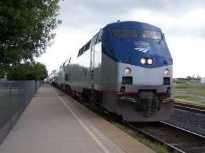 Circumstances, I am happy to say, are obliging me to enlarge my somewhat parochial transportation history research endeavors. Until recently, the furthest I had researched in depth along the old Southern Pacific railroad heading west was Uvalde. I have taken AMTRAK as far as Alpine before and made a couple of trips to Del Rio when I worked for the Union Pacific, but such visits did not involve peeling beneath the surface in any appreciable way. more »
Construction and closures Roads Safety Travel: Hurricane Alex hurricanes storms
by Patrick
Comments Off on Hurricane Alex delivers blow
Hurricane Alex delivers blow

Latest radar from National Weather Service.
Hurricane Alex is grinding into a Mexican coast, its tails whipping South Texas and spitting out tornadoes. Winds are blowing more than 100 mph.
Though the brunt of the storm wandered south, it was powerful enough to drive both Texans and Mexicans away from their homes to find safer shelter, the Associated Press reported. A slew of tornado, flooding and wind warnings are in place in South Texas, including a flood watch in Bexar County, the National Weather Service says.
Officials closed the Queen Isabella Memorial Bridge in South Padre Island due to winds and State Highway 87 in Galveston because of flooding, the Texas Department of Transportation announced. More than 100 TxDOT workers and 200 pieces of equipment will move in tomorrow to open roads and fix traffic signals and signs.
Helpful links:
- National Weather Service
- Weather Channel
- Statewide road conditions, or call (800) 452-9292
- TxDOT hurricane page
SPID is false advertising!
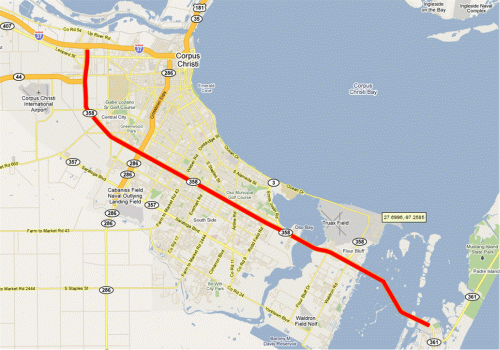
Continuing on Hugh’s Corpus Christi theme from yesterday, my recent Memorial Day weekend vacay (actually it was a pre-Memorial Day weekend vacay) took me to Mustang Island. To get there, we took SH 358, the main drag through Corpus Christi, also known as South Padre Island Drive. However, “SPID”, as it’s known to locals, is a misnomer of sorts because it actually leads to North Padre Island, not South Padre Island, which is a good 120 or so miles south.
So then, why is it named South Padre Island Drive?
The road is actually just Padre Island Drive. The “South” in South Padre Island Drive comes from the fact that there are two halves of Padre Island Drive (although they’re nowhere equal in length): the southern half and the northern half, just like there is North Staples St. and South Staples St. According to Google Maps, it looks like Bear Lane is the dividing line for Padre Island Drive, so there actually is a short section of North Padre Island Drive between there and I-37. The rest of 358 (which is by far the bulk of it) is South Padre Island Drive.
That said, given the possible confusion this could (and probably does) cause, I propose that city leaders in Corpus Christi consider changing the name to “Padre Island Drive South”, although I suppose that PIDS doesn’t have quite the ring to it that SPID does.
Automobiles History Passenger rail Railroads Roads Travel: Corpus Christi
by Hugh
Comments Off on Going to Corpus Christi, then and now
Going to Corpus Christi, then and now
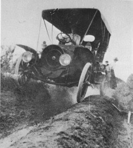
The main road to Corpus Christi, circa 1910
A wee trip to the coast, a fine way to spend a hot and hazy Sunday. While I’m still stuck in bachelor mode – decide to go, jump in the car and away – my wife needs, shall, we say, a little more, um, preparation. Providing my ipod is loaded and charged, I am sorted. She, on the other hand, loaded our vehicle like the old days when we were carrying a baby. Blankets, pillows, books, a lap top for heaven’s sake, towels, changes of clothes, the works. more »
Laws and policies Roads Transit: MPO public meeting
by Brian
Comments Off on MPO holding public meetings for 4 year plan
MPO holding public meetings for 4 year plan
 The San Antonio-Bexar County Metropolitan Planning Organization (MPO) will be holding three public meetings on its 2011-2014 Transportation Improvement Program (TIP). Essentially, this is the revolving list of local transportation projects that are proposed to be funded* over the next three four years (yes, I can count <g>). The projects selected are typically a subset of those in the current long-range plan. Obviously, what eventually does get funded depends heavily on what money eventually comes to this area, but this plan identifies the projects that are first in line to get whatever funding becomes available. The plan includes allocations for all forms of transportation including highways, streets, transit, and bike and pedestrian amenities.
The MPO is the agency charged under state and federal law to control the transportation funding purse-strings for the San Antonio urban area, which in this case includes Bexar County and portions of Comal and Guadalupe counties in the Schertz area. The TIP is required under federal regulations as a condition of receiving federal funding. Projects not in the TIP cannot use federal funds, so this is an important process.
There will be three meetings, all with identical content:
- Tuesday, May 4th from 5:00 p.m. to 8:00 p.m.
- Thursday, May 6th from 11:30 a.m. to 1:30 p.m.
- Saturday, May 8th from 9:00 a.m. to noon
All three will take place at VIA Metro Center on San Pedro just south of SAC. Visitors will also be able to check-out some new interactive systems and discuss the transportation planning process with the folks that make these decisions.
For more information and to see a draft copy of the TIP, click here. Also, see the interactive site here (link added 5/4/10 10:35 am).
(* As I’ve discussed before vis-a-vis the US 281 project, the term “funded” in transportation parlance means that anticipated revenues during the plan timefame will be able to fund a project. Until those revenues are actually allocated to the MPO, a project does not actually have money available to start work.)
My days at the TxDOT photo archive
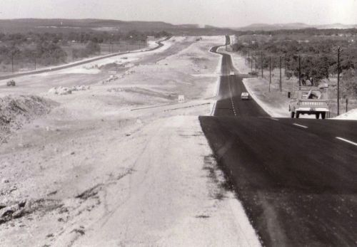
I-10 south of De Zavala looking north, 1966 (TxDOT archive)
After returning from my Florida vacay a couple of weeks ago, I spent the balance of my time off of work at the TxDOT archive in Austin. I had been wanting to go for years after seeing some of the great historical photos from there on other roadgeek websites. I was not disappointed.
Parking Roads Safety Transit: Fiesta
by Patrick
Comments Off on Five things to know before heading to Fiesta events
Five things to know before heading to Fiesta events
Soggy skies put a damper on the start of the year’s biggest party, with officials cancelling tonight’s Fiesta kickoff at Alamo Plaza and moving the opener to Market Square tomorrow. Hope you didn’t head out to Alamo Plaza.
No worries about the revelry cranking up. It will. But before joining the fun, here are some things to check on:
PARKING: Even tested downtown drivers can lose a little focus when Fiesta fills up parking lots and kicks up parking fees. The Express-News has a decent map of parking lots, but alas, doesn’t include fees. MAP
EXPRESS BUSES: Avoid parking altogether by hopping on special Fiesta express buses. VIA set up an event page with details, which includes reroutes of regular services due to street closures. FIESTA BUSES
DRINKING: If you drink, have a drinking and NOT driving plan. The easiest thing to do is assign a designated driver. In a pinch, Yellow Cab will provide up to 700 free rides for certain events, thanks to a state grant. Of course, you can always fork out your own $25 for a cab, and it’ll be a lot cheaper than a $17,000 DWI fine. CALL 222-2222
TRAFFIC: Make it easy on yourself. Just a few minutes checking TransGuide’s site for wrecks and slowdowns can save you an hour on the highway. TRANSGUIDE
WEATHER: Nuff said on that. FORECAST
Now go have a great time. And be safe.
More links:
